Crossing the Sierra Nevada
We run these multi day treks on demand throughout the year, conditions permitting. Summer crossings are tough and will require a certain resilience at times.
Winter trips are strictly the preserve of the mountaineer used to axe and crampon use.The notes below will help you to decide which trip and when to come. All trips require bivouac gear or tents to be carried as camping locations can vary depending on conditions, party etc.
Unguarded huts may be utilised. Please contact us for an update on current mountain conditions and any questions you may have.
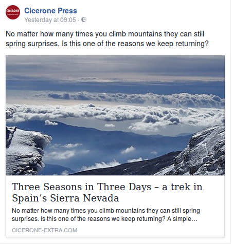
Andalucia's Sierra Nevada lends itself to 2 or 3 day mountain trekking. There are high start points available that give access to magnificent mountain scenery, in the highest mountain range outside the alps in western europe. For those with limited time available in Spain, these crossings of the range allow you to experience the mountains at their best.
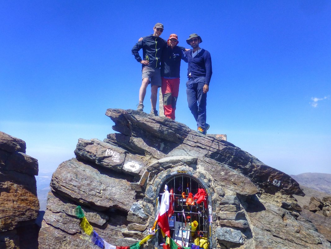
Fourteen of us just back from a week in the Sierra Nevada Mountains organised by Spanish Highs. One of our best trips ever. Climbed Mulhacen, Alcazaba, Veletta and Cerro del Caballo with one overnight in Pogueira refuge. Stayed in Lanjaron in Hotel Espana. Spanish Highs is exceptional. Everything was organised to perfection. Richard the owner and the guides were absolutely brilliant. We cant praise them enough. Nothing could have been better. If you want an awesome trip professionally organised with a personal touch then Spanish Highs is the company to go for. You wont be disappointed. A superb trip by a superb company!! Cara Craig, UK
The Treks, Access and Map
The "Sierra Nevada Crossing" Treks
We have tried and tested 6 of the best multi day traverses around. We try to avoid Mulhacen and Veleta (as highest is not always best?) and show you the best of the rest.
The following are described below:
- Ski area, Elorietta, Tajos los Machos to Puente Palo (2 day) TOUGH
- Ski area, Cartujo, Caballo to Lanjaron (2 day) TOUGH
- Ski area, Cerro los Machos to Capileira (2 day) TOUGH
- Tres Mojones trailhead, Caballo, Cartujo to Ski area (2 day) CHALLENGING
- Hoya del Portillo to Guejar Sierra via Alcazaba and Puntal de Vacares (3 day) VERY TOUGH
- The Remote Northern Peaks to Trevelez (3 day) TOUGH
The map above outlines our normally used routes across the mountain range. We are flexible as to clients wishes and aspirations, provided mountain conditions allow. Underfoot conditions can greatly vary the length/time and overnight stopping points. However, therein lies the adventure and excitement of these treks. We always have options available for early extraction via 4WD vehicles should this be necessary.
It is better to do north to south crossings starting from the Ski Centre at Pradollano. South to north crossings are normally undertaken from the Ventura Trailhead or Hoya del Portillo. Whilst Mulhacen and Veleta may be more popular, these crossings try to utilise the quiet and more remote peaks and passes.
Along with 9 other friends I spent a week with these guys in May. Take it from me the team are excellent. If you want adventure in Sierra Nevada then go with these guys. Helpful, professional and good fun. I'll be back next year for more of the same Alistair (Dalquhurn) via Trip Advisor
Map and Access

Map of the Sierra Nevada with our normal access points noted. The following is the starting height of each access point involved in our "Sierra Nevada Crossing" treks:
- Ski Centre 2500m.
- Trailhead Guejar Sierra 1100m
- Lanjaron 650m
- Ventura Trailhead 2100m
- Puente Palo 1750m
- Capileira 1500m
- Hoya del Portillo 2150m
- Trevelez 1600m
When planning a trip we normally try to start as high as possible. That way we get into the high mountains quicker and easier. For this reason most trips start at the Ski Centre, Hoya del Portillo or Ventura Trailhead
Below we provide examples of some of our more popular treks of both 2 and 3 day duration. We can help with gear and equipment selection and supply. Also have a look through our Latest Trip Reports where you will find examples.
The treks we offer that cross the mountains

Ski area to Puente Palo (2 day)
Outline: Pass via ski terrain, scrambling ridge or mountain flank to unguarded Elorrieta hut (Veleta option). Overnight. Ridge to Tajos de los Machos. Down eastern bowl, traverse to Cebollar ruins, zig zag descent, river crossing, forest trail to pickup.
Time and ascent (ideal summer conditions):
- Day 1 - 4 hrs (750m ascent), (Scramble 6 hrs/900m ascent).
- Day 2 - 6 hrs (200m ascent/1600m descent).
Major peaks covered: Tajos de la Virgen 3191m, Tajos de los Machos 3085m, Cerrillo Redondo 3055m
Notes: Varied terrain specially on Day 2. Elorrieta best overnight viewpoint in the Sierras.
Seasonal notes: The mountain flank to the Elorietta may not be possible under snow as it is an avalanche blackspot. Alternative ascent of Pico del Cartujo will add 3hrs and 300m ascent. Scramble becomes winter graded climb. Have a look at our Detailed Trip Report for an example of this crossing.
Options: The long south ridge from Cerrillo Redondo is slightly quicker and easier to reach Puente Palo. Possible descent to Lanjaron via Tello.
To Puente Palo
Tough Linear hike
|
📏
31
km
|
⏱️
10
hrs
|
|
⬆️
1132
m up
|
⬇️
2995
m down
|
|
📏
31
km
|
⏱️
10
hrs
|
⬆️
1132
m up
|
⬇️
2995
m down
|


Ski area to Lanjaron (2 day)
Outline: Pass via ski terrain, scrambling ridge or mountain flank, pass Elorrieta hut. Climb Pico del Cartujo. Wild camp near Tajos Altos. Ridge over cerro de Caballo, down to Ventura ruins, Tello, Lanjaron
Time and ascent (ideal summer conditions):
- Day 1 - 7 hrs (800m ascent), (Scramble 8 hrs/900m ascent).
- Day 2 - 7 hrs (200m ascent/2400m descent!).
Major peaks covered: Pico del Cartujo 3152m, Tajos Altos 2985m, Cerro de Caballo 3005m
Notes: Great western ridge of the Sierra Nevada. Long and distant, expansive views. Tough descent down to the Alpujarran town of Lanjaron.
Seasonal notes: The mountain flank to the Elorietta may not be possible under snow as it is an avalanche blackspot. Alternative ascent of Pico del Cartujo NW ridge will add 2hrs and 100m ascent. Easy winter walking follows.
Options: An easier return down the Rio Lanjaron to tello or a 4WD pickup at the Ventura trailhead.
To Lanjaron
Tough Linear hike
|
📏
30
km
|
⏱️
14
hrs
|
|
⬆️
1132
m up
|
⬇️
2995
m down
|
|
📏
30
km
|
⏱️
14
hrs
|
⬆️
1132
m up
|
⬇️
2995
m down
|


Ski area to Capileira via Los Machos (2 day)
Outline: Hoya de la Mora, los Posiciones entry into Corral del Veleta, glacial valley below imposing cliffs, remote peak of Cerro de los Machos. Wild camp. Rocky descent, traverse to Loma Pua, Pico del Sabinar and Cebedilla, drop down to Capileira.
Time and ascent (ideal summer conditions):
- Day 1 - 6 hrs (850m ascent).
- Day 2 - 6 hrs (100m ascent/1500m descent).
Major peaks covered: Cerro de los Machos 3329m, Loma Pua, Pico del Sabinar
Notes: High peaks to lush green valleys and gorges
Seasonal notes: Not normally possible in winter due to exposed avalanche loaded slopes and difficult terrain of alpine nature.
Options: Longer return after traversing over Loma Pelada 3181m and Puntal de Caldera 3223m camping by the Laguna del Caldera.
To Capileira
Tough Linear hike
|
📏
20
km
|
⏱️
12
hrs
|
|
⬆️
1085
m up
|
⬇️
2136
m down
|
|
📏
20
km
|
⏱️
12
hrs
|
⬆️
1085
m up
|
⬇️
2136
m down
|


Tres Mojones trailhead to Ski area (2 day)
Outline: High trailhead, gentle ascent to Cerro de Caballo, ridge to Tajos Altos. Wild camp. Pico del Cartujo and drop down via the small lakes of Lagunillas
Time and ascent (ideal summer conditions):
- Day 1 - 6 hrs (800m ascent).
- Day 2 - 5 hrs (300m ascent/700m descent).
Major peaks covered: Cerro de Caballo 3005m, Tajos Altos 2985m, Pico del Cartujo 3152m
Notes: The western ridges of the Sierra Nevada. Good ridge walking, remote mountain lakes and easier descent than others on this page.
Seasonal notes: Generally easy winter walking in good snow conditions. The mountain flank to the Elorietta may not be possible under snow as it is an avalanche blackspot. Alternative descent of Pico del Cartujo NW ridge recommended.
Options: Instead of the high ridge we can take the slightly easier Verada Cortado. This traverses impressive rock scenery and beautiful lakeside camping locations.
To Ski Area
Challenging Linear hike
|
📏
18
km
|
⏱️
11
hrs
|
|
⬆️
1156
m up
|
⬇️
797
m down
|
|
📏
18
km
|
⏱️
11
hrs
|
⬆️
1156
m up
|
⬇️
797
m down
|


Hoya del Portillo to Guejar Sierra (3 day)
Outline: Forest trailhead, gentle ascent to Mirador de Trevelez. Contour east to Siete Lagunas. Wild camp. Alcazaba, Puntal de Vacares, Laguna de Vacares. Wild camp. Return down Loma del Calvario to Verada de Estrella and trailhead.
Time and ascent (ideal summer conditions):
- Day 1 - 6 hrs (900m ascent). Day 2 - 7 hrs (600m ascent).
- Day 3 - 5 hrs (100m ascent, 2200m descent).
Major peaks covered: Alcazaba 3371m, Puntal de El Goteron 3067m, Puntal de las Calderetas 3066m, Puntal de Vacares 3136m
Notes: Long remote trek over high and at times difficult peaks. Best camping spots in the Sierras. Long descent.
Seasonal notes: A major undertaking. Only recommended for fit and experienced under good snow and ice conditions.
To Guejar Sierra
Very Tough Linear hike
|
📏
30
km
|
⏱️
18
hrs
|
|
⬆️
1404
m up
|
⬇️
2032
m down
|
|
📏
30
km
|
⏱️
18
hrs
|
⬆️
1404
m up
|
⬇️
2032
m down
|


Remote Northern Peaks to Trevelez
Outline: Loma de los Cuartos trailhead to Pena Partida and Lavederos de la Reina valley. Wild camp. Ridge walk of the northern peaks to Laguna de Vacares and drop down to Horcajo area. Wild camp. Return down Rio Trevelez valley to Trevelez village.
Time and ascent (ideal summer conditions):
- Day 1 - 3 hrs (300m ascent).
- Day 2 - 7 hrs (1000m ascent). Day 3 - 5 hrs (2200m descent).
Major peaks covered: Picon de Jerez, Puntal de Juntillas, Puntal de los Cuartos 3158m, Atalaya 3135m, Pico del Cuervo 3144m
Notes: Great traverse of the northern peaks. The Pena Partida is one of the least visited huts in the Sierras. Great ridge round on day 2. Long descent day 3.
Seasonal notes: Relatively straightforward, if long and tough winter expedition.
Northern Peaks
Tough Linear hike
|
📏
32
km
|
⏱️
15
hrs
|
|
⬆️
1741
m up
|
⬇️
2709
m down
|
|
📏
32
km
|
⏱️
15
hrs
|
⬆️
1741
m up
|
⬇️
2709
m down
|

Dates & Prices
When?
Prices
ie "Los Tres Miles" and "Los Tres Picos" treks
Group size (per booking): (prices are per person per day)- 1 person - cost €155
- 2 persons - cost €105
- 3 persons - cost €95
- 4 persons - cost €80
Definition of "Group" - if you are booking a trip for 2 persons the 2 person rate applies, 3 persons - 3 person rate etc (not dependent on eventual total group size!).
Price includes:- Guiding
- Backup vehicles
- We have a limited number of walking poles for the use of guests if required
- Gear hire in winter conditions ie ice axe, crampons, helmet. Also stove if required.
Larger groups - discounts apply. Enquire via email or contact form
Transport (effective for all bookings after 1st July 2022)
The guiding price above does not include transport. Due to rising energy and fuel prices we do not want to be constantly changing guiding prices to reflect transport costs. We want to be honest and open about our price structure.
Clients have two options:
NO COST OPTION - Pick up/drop off our guide in Lanjaron or a venue to be agreed. Use your own transport to and from the start/end of activity.
COST OF FUEL OPTION - Our guide will drive you to/from start/end of activity in one our own vehicles. Applicable costs are:
- Capileira, White Villages, Taha del Pitres €25
- Hoya del Portillo €35
- Sierra Nevada ski area €35
- Granada area, Cumbres Verdes €20
- Peñon de la Mata €25
- Lecrin Valley €15
- Jerez de Marquesado, Eastern Sierra Nevada €60
N.B For destinations not listed above we can easily work out a fuel cost
You may also be interested in?
Guided Trekking Tours in the Sierra Nevada, Spain
Sierra Nevada trekking holidays and tours inc Mulhacen, Veleta, ridge traverse, Siete Lagunas and high peaks. Day or multi day treks from Lanjaron, Capileira or Granada
Tres Miles 5 day trek Sierra Nevada Spain, 3000m mountains
A stunning high altitude guided trek, wild camping, traversing the main 3000m peaks of the Sierra Nevada in quiet and remote mountains. This is Los Tres Miles!
Climb Mulhacen, Sierra Nevada, highest mountain in mainland Spain
Guided day or multi day ascents year round of Mulhacen in Spains Sierra Nevada. Climb it, trek it, scramble it, ski it or even sleep on it!
Guided Trek Sulayr GR240 Long Distance Path, Sierra Nevada
Week long guided trek along the northern section of the Sulayr long distance path that encircles the Sierra Nevada mountain range in southern Spain
Guided Trekking in Los Glaciares National Park, Patagonia
Tours around Cerro Torre, Fitzroy and Paso Viento. Day and multi-day trekking and hiking from El Chalten, Patagonia