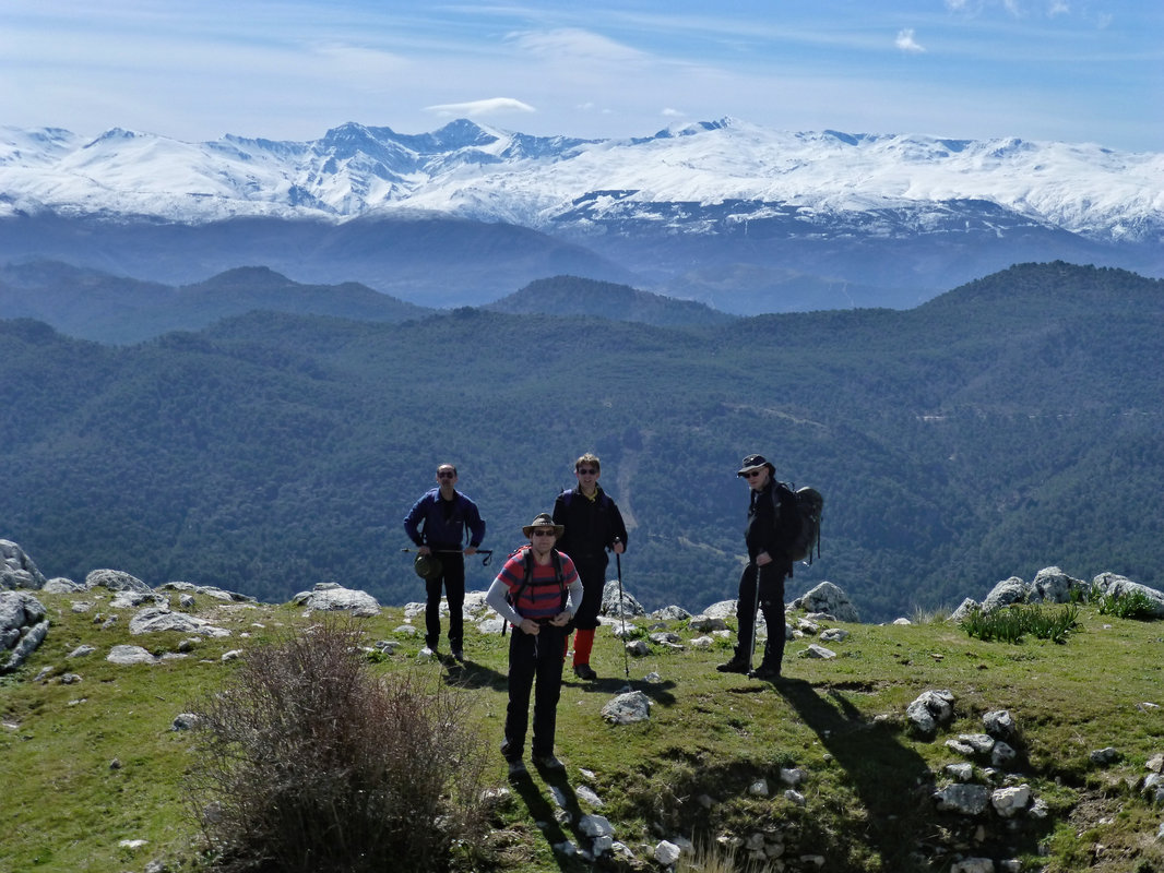
Highlights from the Sierra de Almijara mountains
Hiking in the Sierra de Almijara, part of the larger Sierras de Tejeda, Almijara y Alhama Natural Park, is especially rewarding due to its remarkable landscapes, unique geology, diverse flora and fauna, and beautiful Mediterranean views.
Here's what's particularly good about hiking there:
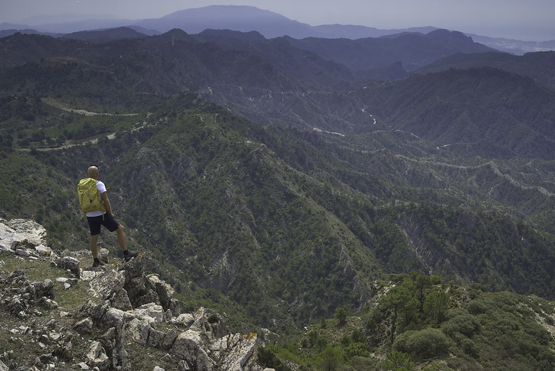
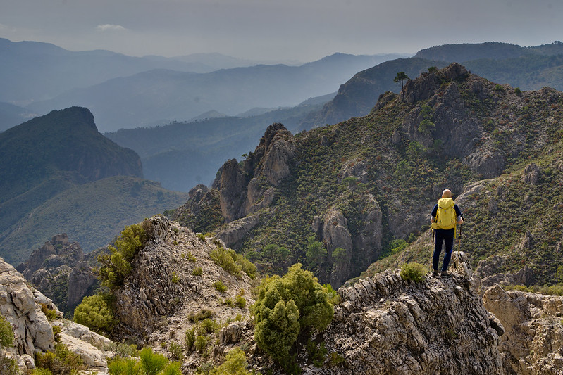
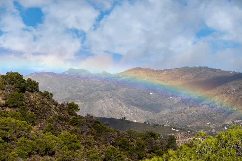
Breathtaking Mountain and Sea Views
- Stunning panoramas stretching from rugged mountains down to the Mediterranean Sea.
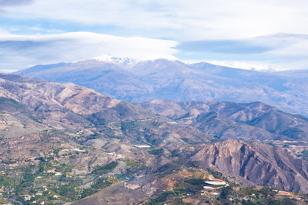
- Exceptional viewpoints overlooking the Costa Tropical, Costa del Sol, and distant North African coast on clear days.
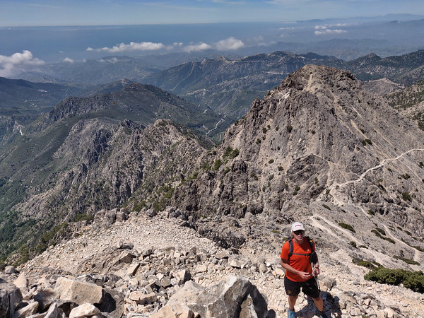
Dramatic Limestone Landscapes
- The area is known for its distinctive white marble and limestone rock formations, creating spectacular cliffs, ravines, caves, and steep gorges.
- Unique geological features like natural arches, karstic landscapes, and striking ridges.
Rich Biodiversity and Wildlife
- Home to diverse ecosystems, including Mediterranean forests, mountain scrublands, rivers, waterfalls, and alpine areas.
- Habitat for wildlife such as mountain goats (Ibex), wild boars, golden eagles, peregrine falcons, and many other bird species.
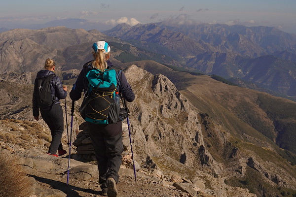
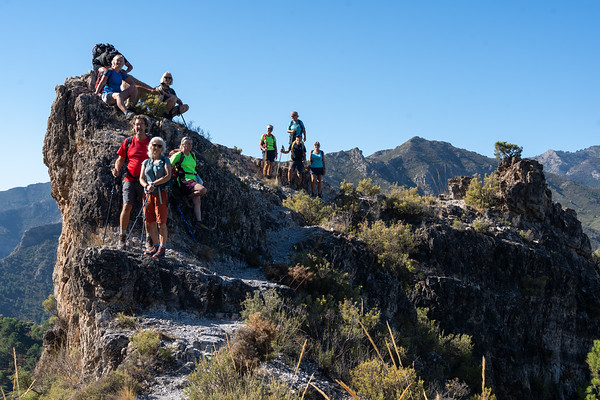
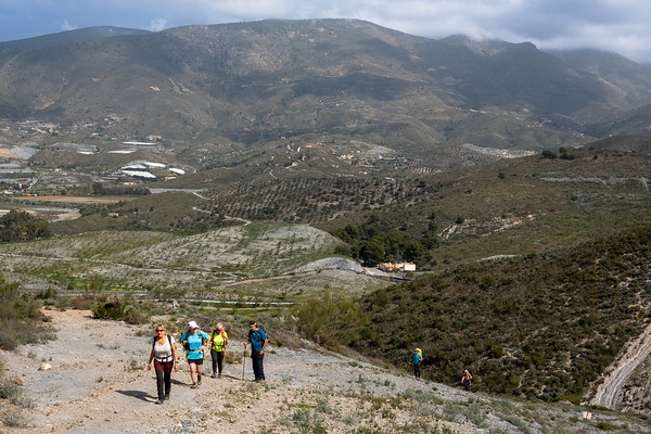
Numerous Trails and Peaks to Explore
- Variety of hiking routes, from easy walks to demanding mountain ascents.
- Popular summits: Pico del Cielo (1,508 m), Navachica (1,832 m), El Lucero (1,774 m), and La Maroma (2,066 m, highest peak in the nearby Sierra de Tejeda).
- Iconic trails include the ascent of El Lucero, offering stunning 360-degree panoramas.
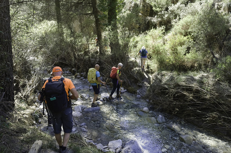
Crystal-Clear Rivers and Waterfalls
- Beautiful rivers like Río Chillar, famous for its summer river walks (refreshing hiking directly through water).
- Opportunities to swim in cool mountain pools, waterfalls, and river canyons.
Tranquility and Solitude
- Less crowded than some other Spanish mountain areas, allowing for peaceful hikes and authentic connection with nature.
- Excellent for hikers seeking quiet trails and a serene atmosphere.
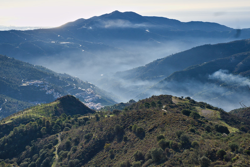
Historical and Cultural Attractions
- Trails often pass through historical sites, abandoned villages, ancient mule paths, Moorish ruins, and archaeological points of interest.
- Nearby picturesque villages like Frigiliana, Cómpeta, and Nerja offer cultural charm and gastronomy.
Practical Tips:
- Best Seasons: Spring (wildflowers, mild temperatures) and autumn (clear skies, cooler temps).
- Summer: Early morning starts recommended; river hikes ideal.
- Gear: Hiking boots, sunscreen, hat, ample water, and swimming gear (river trails).
Conclusion:
Hiking in the Sierra de Almijara is particularly special due to its blend of rugged mountains, sea views, wildlife, varied trails, cultural charm, and peaceful natural settings, making it an outstanding destination for hikers and nature lovers alike.
Day Hikes in the Sierra de Almijara
Cerro Lucero
Challenging
| Distance: | 11 km |
| Ascent: | 858 m |
| Time: | 6 hrs |
Climbing Cerro Lucero (also known as Raspón de los Moriscos, 1,779 m) from the north side offers a wild and beautiful hike through the remote heart of the Sierra Almijara, with panoramic views stretching from the Mediterranean coast to the Sierra Nevada. This northern route is more adventurous and less frequented than the popular southern approach from La Resinera or Competa.
La Maroma from the north
Tough
| Distance: | 16 km |
| Ascent: | 965 m |
| Time: | 7 hrs |
Hiking La Maroma (2,066 m) — the highest peak in the Sierra de Tejeda — from the north is a spectacular and lesser-traveled approach to this iconic summit. Unlike the more popular southern route from Canillas de Aceituno, the northern route offers alpine forest, solitude, and impressive views over the Arenas del Rey and Alhama de Granada areas.
Circular Lentegi PR440
Challenging
| Distance: | 16 km |
| Ascent: | 697 m |
| Time: | 6 hrs |
Embarking on the PR-A 440 Jaloche - Cortijo de Lizardo trail offers hikers a challenging yet rewarding experience in the picturesque landscapes surrounding Lentegí, Granada. This circular route is renowned for its diverse terrains, scenic vistas, and cultural landmarks.
Pico Lopera
Moderate
| Distance: | 9 km |
| Ascent: | 269 m |
| Time: | 5 hrs |
From the trailhead, the path ascends steadily through a landscape characterized by typical Mediterranean vegetation. The trail is well-marked but can be rocky in sections, so sturdy footwear is recommended.
Upon reaching the summit at 1,481 meters, hikers are rewarded with expansive views of the surrounding sierras and valleys. The vantage point provides a unique perspective of the rugged terrain and, on clear days, glimpses of the Mediterranean Sea.
The descent follows a looped path that brings hikers back to the starting point, offering different scenery and perspectives along the way.
The Lentegi Skyline
Moderate
| Distance: | 12 km |
| Ascent: | 280 m |
| Time: | 5 hrs |
Exploring the ridges above the village of Lentegí in Andalusia offers hikers a chance to experience the rugged beauty of the Sierra de Almijara. This region is characterized by steep limestone formations, dense pine forests, and panoramic views of the Mediterranean coastline.
Río Bacal Jayena - Sendero de los Arrieros
Challenging
| Distance: | 17 km |
| Ascent: | 377 m |
| Time: | 7 hrs |
Embarking on the Río Bacal and Sendero de los Arrieros hike near Jayena offers a captivating journey through the natural beauty of the Sierras de Tejeda, Almijara, and Alhama Natural Park. This trail combines serene river landscapes, historical pathways, and panoramic vistas, making it a memorable experience for outdoor enthusiasts.
Petrified Waterfall Rio Verde
Moderate
| Distance: | 9 km |
| Ascent: | 414 m |
| Time: | 5 hrs |
Hiking to the Petrified Waterfall in the Río Verde area near Otívar, Granada, offers an enriching experience that combines natural beauty with a touch of geological intrigue. This trail is renowned for its scenic landscapes, including the unique petrified waterfall where mineral-rich waters have fossilized tree trunks over time.
Ventana de los Guajares, Molvizar
Challenging
| Distance: | 11 km |
| Ascent: | 613 m |
| Time: | 5 hrs |
From Molvízar, hikers ascend via the Loma de los Pinillos, connecting to the Vereda del Minchar de Arriba. The path continues through varied terrains, including the Barranco Seco del Minchar and the Cuerda del Jaral, before reaching the Ventana de los Guájares. The descent leads through the Barranco del Búho, eventually returning to Molvízar.
Villages of los Guajares
Leisurely
| Distance: | 6 km |
| Ascent: | 270 m |
| Time: | 3 hrs |
Circular route that begins in Guájar Fondón and leads hikers through the hills above the villages of Los Guájares. The hike starts with a steep ascent to El Castillejo, offering panoramic views of the surrounding area. The trail then descends, crossing the Río Toba, and continues into the village of Guájar Faragüit before looping back to the starting point in Guájar Fondón
Cerro Toro and Cerro Gordo, Motril
Moderate
| Distance: | 11 km |
| Ascent: | 488 m |
| Time: | 4 hrs |
The trail ascends from El Mirador, passing by landmarks such as the Túnel de la Gorgoracha and the Fuente de la Bullarenga. Hikers then proceed through the Barranco de las Provincias to the Parque Cerro del Toro, culminating at the Cerro del Toro summit.
The summit provides expansive views of Motril, its port, and the surrounding landscapes. The trail traverses diverse terrains, including forests, valleys, and water features, offering varied scenery.
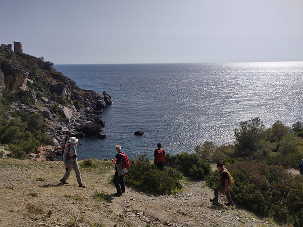
Coastal Walk - Cortijada Cantarriján
Leisurely
| Distance: | 5 km |
| Ascent: | 345 m |
| Time: | 3.5 hrs |
The hike begins near Playa Cantarriján, a beach known for its clear waters and natural beauty. From here, the trail ascends through varied terrain, including pine forests and coastal scrub, leading to the traditional Andalusian farmhouse, Cortijada Cantarriján. Along the way, hikers are rewarded with panoramic views of the Mediterranean Sea and the rugged coastline.
For those seeking to extend their adventure, an additional loop leads to the Cerro Caleta, offering vistas of the surrounding cliffs and beaches. The descent from Cerro Caleta brings hikers to Playa del Cañuelo, a secluded beach perfect for a refreshing swim. The return journey traverses coastal paths back to the starting point, completing a circular route
Dates & Prices
When?
Prices
Group size (per booking) (prices are per person per day)- 1 person - cost €110
- 2 persons - cost €75
- 3 persons - cost €65
- 4 persons - cost €55
Definition of "Group" - if you are booking a trip for 2 persons the 2 person rate applies, 3 persons - 3 person rate etc (not dependent on eventual total group size!).
Price includes:- Guiding (Alpujarras, Granada area, Lecrin Valley, Costa del Sol, Granada
- We have a limited number of walking poles for the use of guests if required
N.B Meeting place to be agreed upon, normally Lanjaron or the start of the walk
Larger groups - discounts apply. Enquire via email or contact form
Transport (effective for all bookings after 1st July 2022)
The guiding price above does not include transport. Due to rising energy and fuel prices we do not want to be constantly changing guiding prices to reflect transport costs. We want to be honest and open about our price structure.
Clients have two options:
NO COST OPTION - Pick up/drop off our guide in Lanjaron or a venue to be agreed. Use your own transport to and from the start/end of activity.
COST OF FUEL OPTION - Our guide will drive you to/from start/end of activity in one our own vehicles. Applicable costs are:
- Capileira, White Villages, Taha del Pitres €25
- Hoya del Portillo €35
- Sierra Nevada ski area €35
- Granada area, Cumbres Verdes €20
- Peñon de la Mata €25
- Lecrin Valley €15
- Jerez de Marquesado, Eastern Sierra Nevada €60
N.B For destinations not listed above we can easily work out a fuel cost
You may also be interested in?
Day walks in the Cumbres Verdes mountains near Granada
Various guided day mountain walks of all grades visiting the beautiful and varied Cumbres Verdes range just south of Granada
Day Walking Tours to mountain lakes of the high Sierra Nevada, Spain
Escape the heat! Join us for day and multi-day hiking trips to visit the beautiful, quiet summer mountain lakes of the Sierra Nevada
Guided Day Walks Tabernas desert badlands, Almeria
Amazing guided day walking tour in the incredible desert badland landscapes of Tabernas, Almeria, visiting scenes from major movies and spaghetti westerns
Join Chris Stewart Walking Weeks in the Alpujarras, Spain
We have teamed up with writer Chris Stewart and delightful accommodation at Casa Ana for you to enjoy a weeks guided walking holiday in the Alpujarras
Climb the high peaks of the Sierra Nevada in Spain with us
Guided day or multi-day summer or winter mountain ascents of the high peaks of the Sierra Nevada