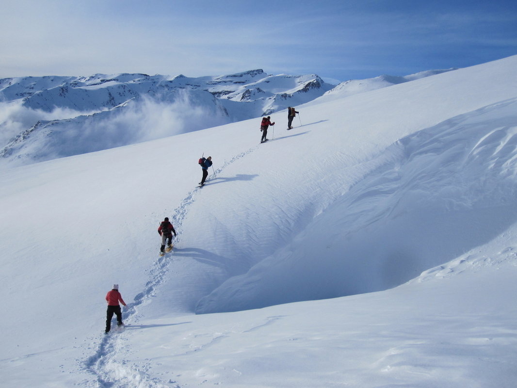
As an aid to climbers, mountaineers, ski tourers and walkers for each winter season, each winter we post Avalanche Information and Risk Assessments on our Weather Page based on the highly successful Scottish service that has been in use for many years.
As we are in the hills most days during the winter and are consistently in a position to evaluate the danger, this safety information will be made available to all interested parties through our websites and blogs. This service is in operation from mid-December each year and will be updated as and when conditions materially change.
Avalanches
Most winters after fresh snowfall there are avalanches all over the Sierras, but they are normally small and localised. The exception was in February 2011 when a massive slide nearly 1km wide in the Barranco de San Juan killed 1 person and injured 2 others.
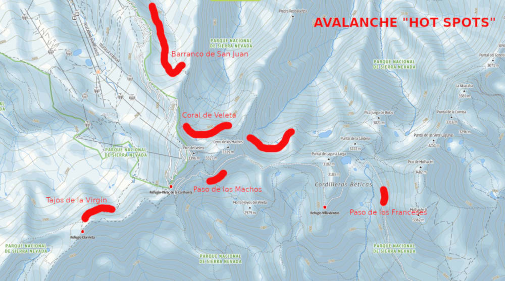
Click map below for enlarged, clearer version
There are 4 major black spots that regularly avalanche. They have become black spots because they cross normal walking or hiking trails that people use. They are:
- NW of the Tajos de la Virgen ridgeline on the track between Lagunillos de la Virgin and the Refugio de Elorietta. This path crosses steep and dangerous avalanche terrain just after leaving the Elorietta hut heading NNW. The proximity to the ski centre increases human traffic in this area. For experienced mountaineers the ridge of the Tajos de la Virgen is safer or the whole can be avoided by an easy, safer but longer snow ascent up the Tozal de Cartujo via the bowl W of the NW ridge of the Cartujo.
- Paso de los Franceses on the the SW slopes of Mulhacén above the normal walking track up the Rio Mulhacén. In particular the old road above this area can be very dangerous. Give this a wide berth westwards on the approach to the W flank route up Mulhacén or the Col de Ciervo. In 1989 an accident here cost the lives of 6 French mountaineers.
- Paso de los Machos on the S side of Cerro de Los Machos where the old road cuts through a small pass. This area is normally heavily loaded with snow. This path is used as a quick and easy approach from the Cariguela to Mulhacén or the Poqueira/Caldera areas. If heading for the Refugio Poqueira a safer descent is via Loma Pua, Pico de Sabinar and cut through the Terreras Azules below the Pico del Pulpito
- Barranco de San Juan – close to Hoya de la Mora and low altitude increase risk to mountain goers. Usually full of wind blown snow after major snowfalls. Lots of small localised dangers but a massive avalanche in February 2011 has increased awareness of the potential for large scale slides here
Of course, normal good mountaineering and avalanche awareness practices must be observed on all routes in the high mountains, but the above black spots can and should always be avoided or by-passed.

Icing
After a southerly front from the African continent passes northwards through the Sierra Nevada there is a rapid rise in temperatures followed by the quick return to the norm of below zero. This leaves the Sierra Nevada like a gigantic “block of ice” where a slip from a tired or inexperienced mountaineer can have disastrous consequences.
In winter 2014 many experienced mountaineers got into difficulties on simple routes and had to ask for assistance from the rescue services. Forget about ski touring in these conditions and stick to the pistes!
Wind
Predominantly from the west they are a constant companion in the high mountains. It is not uncommon for gusts of over 120km/hr to be recorded every winter, indeed an exceptional winter gust of over 250 Km/hr was once recorded at an altitude of 2800m.
Progress will be difficult and may well be impossible in winds over 60km/hr, especially or ridge crests and in areas where the wind is funneled through passes such as the Collado de Carihuela. When strong, bitterly cold winds arrive from the north then the windchill will be extremely high.
Blizzards
Needless to say a combination of snow and high winds can make these relatively gentle and easily accessible mountains into a life and death struggle. It is important to remember and respect the high altitudes and sometimes long distances involved to safety.
Local mountaineers don’t leave home in these conditions, but if you do happen to get caught out then it is important to have done your homework before setting out regarding map, compass, escape routes etc. With today’s wealth of internet weather resources available then this should not occur.
Snow Bridge Collapse
This occurs in the spring melt when rivers and streams carve tunnels beneath the valley snows. The unstable snows above look perfectly fine to walk on but can collapse causing injury.
Electrical Storms
These are common occurrences in the late spring and autumn but are rare in winter. Usually sufficient warning of these risks will be posted on the AEMET website

Avalanche Hazard Scale
Degree of hazard - 1 LOW
- Snowpack stability - The snowpack is generally well bonded and stable
- Avalanche probability - Triggering is possible only with high additional loads (note 2) on a few very steep extreme slopes (note 4). Only a few small natural avalanches (note 6) possible
- For off-piste & back-country activities - Virtually no restrictions on off-piste & back-country skiing & travel
Degree of hazard - 2 MODERATE
- Snowpack stability - The snowpack is moderately well bonded on some (note 1) steep slopes (note 3), otherwise generally well bonded
- Avalanche probability - Triggering is possible with high additional loads (note 2), particularly on the steep slopes (note 3) indicated in the bulletin. Large natural avalanches (note 6) not likely.
- For off-piste & back-country activities - Generally favourable conditions. Routes should still be selected with care, especially on steep slopes (note 3) of the aspect (note 5) and altitude indicated.
Degree of hazard - 3 CONSIDERABLE
- Snowpack stability - The snowpack is moderately to weakly bonded on many (note 1) steep slopes (note 3).
- Avalanche probability - Triggering is possible, sometimes even with low additional loads (note 2). The bulletin may indicate many slopes which are particularly affected. In certain conditions, medium and occasionally large sized natural avalanches (note 6) may occur.
- For off-piste & back-country activities - Off-piste and back-country skiing and travel should only be carried out by experienced persons able to evaluate avalanche hazard. Steep slopes (note 3) of the aspect (note 5) and altitude indicated should be avoided.
Degree of hazard - 4 HIGH
- Snowpack stability - The snowpack is weakly bonded in most (note 2) places
- Avalanche probability - Triggering is probable even with low additional loads (note 2) on many steep slopes (note 3). In some conditions, frequent medium or large sized natural avalanches (note 6) are likely
- For off-piste & back-country activities - Off-piste and back-country skiing and travel should be restricted to low-angled slopes; areas at the bottom of slopes may also be hazardous.
Degree of hazard - 5 VERY HIGH
- Snowpack stability - The snowpack is generally weakly bonded and largely unstable
- Avalanche probability - Numerous large natural avalanches (note 6) are likely, even on moderately steep terrain
- For off-piste & back-country activities - No off-piste or back country skiing or travel should be undertaken
Notes
- Note 1 - Generally described in more detail in the avalanche bulletin (e.g.altitude, slope aspect, type of terrain, etc)
- Note 2 - Additional load: high - e.g. group of skiers, pistemachine, avalanche blasting.low - e.g. skier, walker
- Note 3 - Steep slopes: slopes with an incline of more than 30 degrees
- Note 4 - Steep extreme slopes: those which are particularly unfavourable in terms of the incline, terrain profile, proximity to ridge,smoothness of underlying ground surface
- Note 5 - Aspect: compass bearing directly down the slope.
- Note 6 - Natural: Without human assistance.
You may also be interested in?
Mountain Weather Information Sierra Nevada, Spain inc Mulhacen
Comprehensive mountain weather forecasts for Mulhacen, Sierra Nevada and Andalucia area for mountaineers, walkers and skiers
Avalanche Information, Sierra Nevada Spain, Mountain Danger and Risk
Where do avalanches tend to come down in the Sierra Nevada? What other dangers may be found here?

