Background
Ian Tupman describes a challenging walk from the coast at Salobrena to the lofty summit of Mulhacen, highest summit in Spain
On two occasions I had driven from Salobreña on the coast to Trevélez at 1,500m in the hope of summiting Mulhacén in a one day trip. Both times I reached around 3,200m when I started to feel dizzy, had a racing pulse and a banging headache. My body was telling me I had ascended too quickly from sea level and so I turned back.

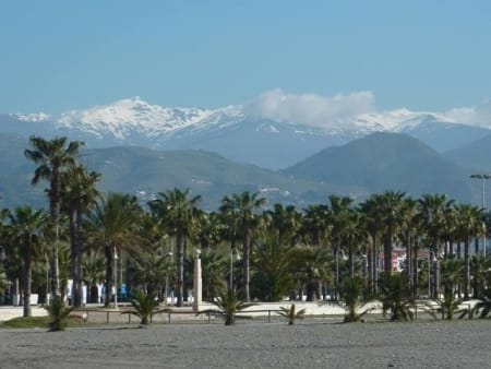
The Sierra Nevada as seen from the beaches of the Costa Tropical
}It seemed logical that if I started at sea level and walked all the way to the summit, my body would acclimatize slowly and so the idea of the Sea2Sky walk came about. I discussed it with a friend who said he would be interested in joining me and I set about planning the most direct route. This would take us up and over the coastal range of hills (La Contraviesa), through the eastern end of La Tahá, along part of the GR7 long distance path to Trevélez, up to the Siete Lagunas at 3,000m and then an early morning ascent of Mulhacén. We decided that weather-wise, early June would be a good time as the last of the winter snow would have disappeared and it wouldn’t be too hot during the day.
Day 1 – Castillo de Baños to Torvizcón (24kms and 1,273m of ascent)
We were dropped off at 9.00am on the beach at Castillo de Baños. We picked up a couple of pebbles and sea shells (which we would leave on the summit of Mulhacén) and we started up the GR6204 to Polopos. We knew the whole of the first day would be on tarmac roads so we wore lightweight shoes rather than boots but even so, with the temperature reaching the low thirties, we were glad of the rest while we ate our sandwiches at Venta del Chaparro. As we started the 8km descent to our overnight stop in Torvizcón, we caught a glimpse of our objective rising above its neighbouring peaks of the Sierra Nevada.
Day 2 – Torvizcón to Trevélez (26kms and 1,246m of ascent)
Back on the tarmac again, we passed Almegijar before turning off the road and a welcome descent on a good footpath down to the Rio Trevélez in La Tahá. This area was occupied and cultivated by the Arabs because of its abundant natural spring water and fertile soil and is an excellent walking area in its own right. We made a short diversion from our route for tea and home-made cake at the little cafe-bar in Ferreirola before climbing again to Busquistar for our lunch break.
From Busquistar we took the well-signposted GR7. The route traverses the western flank of the Rio Trevélez valley, passing through oak forests which provided welcome shade from the sun, and fantastic views up the valley towards Trevélez and the mountains beyond. After almost ten hours of walking, we reached Trevélez in the early evening and our billet for the night. Knowing we didn’t have an early start in the morning, we ate well at La Fragua which probably serves the best food in the Alpujarra.
Day 3 – Trevélez to Siete Lagunas (9kms and 1,500m of ascent)
After a relaxing morning sitting on the hotel terrace in the sunshine, we had lunch at La Fragua. When the owner heard we were heading for Mulhacén, he insisted on filling our flask with rioja. Who were we to object? The marked footpath rises steeply out of Trevélez but then eases as it gradually heads north-west giving superb views. We were surprised to have to cross so much snow on the path and the large volume of melt water added a certain frisson to a couple of the river crossings.
After a steady five hours walking, we arrived at the Siete Lagunas and, considering how good the weather was, I was expecting to see dozens of people already there. Amazingly we had the place to ourselves all night....until one of our food containers was spirited away by a fox in the early hours. The sky was perfectly clear and our bivouac in a rock shelter became a natural planetarium with the night sky passing overhead. We counted numerous satellites and spotted the international space station just above the horizon.
Day 4 – Siete Lagunas to Mulhacén summit and descent to Hoya del Portillo (13kms and 481m of ascent)
The clear sky meant we had a cold night but as soon as the sun rose, its warmth melted the ice on our sleeping bags and we breakfasted on what food the fox hadn’t managed to find. We packed our gear and climbed steadily to reach the summit of Mulhacén at 9.00am, exactly seventy two hours after dipping our feet in the Mediterranean. The rioja was consumed, absent friends were toasted and we enjoyed the amazing views for half an hour or so before setting off on the long descent down the south ridge. Four hours walking brought us to the car park at Hoya del Portillo and our transport back down to the coast.
Ian Tupman June 2009
NOTES
-
Since we did the walk, winter storm damage has washed out some of the small river valleys between Busquistar and Trevélez making them difficult to cross. A recce trip should be undertaken to assess the current state of this part of the route.
-
We carried all of our kit for the four days, including boots for the mountain sections and sleeping bags for the bivouac. Arrangements could be made to collect these at Busquistar or Trevélez to keep weight down, especially if high temperatures are forecast.
-
The tarmac sections on the first two days could be omitted by starting the walk in La Tahá. This should still give sufficient time to acclimatize to the altitude.