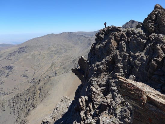
Here is a route description of how to do it.
N.B This route description applies to summer only. Please wear a helmet as there is plenty of loose rock! No need for a rope unless you have beginners or want to push the grades.
We caught the first chairlift access from Pradollano, ski centre in the Sierra Nevada. Arriving at 2900m at 10:30 we made swift progress on the old road over the Col de Carihuela.
From there we took the short "via ferrata" at Paso de las Guias to save 15 minutes and regain the old road near Paso de los Machos. By the time we reached the start point of the scramble at Loma Pelada we had been walking 1.5 hours.
Now things get interesting. From the start at the summit of Loma Pelada north, the ridge heads eastwards in a convoluted and chaotic way towards the Puntal de la Caldera (3223m).
More photos at https://www.flickr.com/photos/spanishhighs/sets/72157646735674365/
The whole ridge is characterized by some solid section of rock on the ridge crests, but as soon as you leave the crest you will encounter a combination of steep ground and loose rock. It is immediately apparent that a huge crag bars the route half way along the ridge. This is the crux section.
The initial going is straightforward. Try to keep to the crest for maximum scrambling. Easy enough, some nice grade 2 sections if you want. There are a couple of moments where the best route onwards is to be bold (both in ascent and descent). A raising of the standard momentarily to grade 3. This is preferable to the avoiding tactic, usually to the right, which is easy but ends up on loose rock.
At the col before the massive crag that bars the way you have two choices.
-
Follow goat tracks horizontally until the track abuts against the Espolon de Puntal de la Caldera. Follow the ridge up to the summit. This is marked blue on the photo below. This is loose (as is everything hereabouts!), but straightforward. This is the simplest way to the summit but with little scrambling.
-
From the col before the large crag the best way trends leftwards up a ramp formed by huge boulders (marked red on photo below). This leads to an initial gully which can be climbed rightwards to the ridge crest at grade 3. We kept trending left up rising ground on slabby rock. There were many routes here, all of grade 1/2 standard. The ridge crest was regained and we continued to the summit linking as many of the rock outcrops as we could. Harder options abound if you prefer!

Red - ridge route bypass. Blue - traverse and upper Espolon
The descent of the east ridge to the Collado de Ciervo is easy (grade 1). Keep to the ridge crest for maximum enjoyment rather than be tempted to take avoiding action. In front of you rises the impressive north wall of Mulhacén (3482m, highest mountain in western europe outside of the Alps), with Alcazaba to the left. At the col it's a 10 minute walk to the Refugio de la Caldera and the regular walking tracks.
This is a scramble well worth doing and can be done in a day. From the start of the scrambling (Loma Pelada) to the end at Collado de Ciervo took us 1.5 hours. We took our time, savoring the incredible situations. Please try it out for yourself!
Sierra Nevada Scrambling
Spanish Highs run Scrambling tours/weeks throughout the summer months from May to November inclusive. In winter this route makes for a superb winter mountaineering climb which we include as part of our Alpine Mountaineering Courses.
Spanish Highs - "Inspiring the Adventure" in the Sierra Nevada!

The west ridge of the Caldera from near the start

Slabby section just before regaining the main ridge

Prow just below the summit

The initial scramble left of the main crag (crux)

The summit ridge
