Here is a report sent in about one such self guided trek.
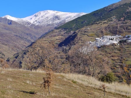
The first three days of our trip we took the sulayr route (roughly stages 4 – 6). That was generally relatively easy walking, although the climb from Lanjaron to the Sulayr trail (well marked and clear trail) didn’t really allow for an easy start. Also some parts of the route included pretty challenging uphill sections and notably the stage to Trevelez is quite long (18km). We camped at Puente Palo and took hotels in Capileira and Trevelez (where we watched our national soccer team lose the semi final of the world cup).
Day 4 - Then from Trevelez we followed the stream up the valley, which turned out to correspond to a white and green marked route to ‘El Horcaje’. Lots of wet sections there, as many streams end up on the trail. Had to stay focused there. At some point the marked route ends (clearly indicated by a sign), but we had to go on until Laguna del Puente. Traversed some steep gradients on our way there, couldn’t really find a trail. We ended up camping on a beautiful spot by Laguna del Puente.
Day 5 – Then we tried to intersect the Integral de los 3000, but again we couldn’t really find a clearly marked trail, if there even was one. Navigated our way using the map and gps over the loose rocks and faced some tough winds on those first peaks. The original plan was to go as far as 7 lagunas, but because of the navigation issues and the absence of a trail we moved a lot slower than we hoped and ended up camping at Laguna de los Vacares. In hindsight this was a much better place to camp than 7 lagunas because of the crowds in the latter area.
Day 6 – Picked up the route from Laguna de los Vacares and headed towards 7 lagunas and Mulhacen. Again there was no obvious trail in all sections, but we got to 7 lagunas on our own navigation. We were surprised by the amount of people in that area. The previous 5 days we’d only seen a few local men on horses trailed by dogs and a handful of tourists on the sulayr trail. Decided to climb Mulhacen and descend on the other side to Refugio de la Caldera. Found a nice spot next to a small group of lakes nearby the refugio. That night there was a nearly full moon, so we were awoken a few times by groups of walkers that apparently did moonlight walks.
Day 7 – An easy part from La Caldera towards Veleta. No way to miss that trail… But when we got to the Refugio de carihuela, we took a path on the wrong side of the ridge. Tried to correct our error by taking the route on the ridge from pico de elorietta to the refugio the elorietta, but that turned out to be a hazardous endeavor for us. We turned back and went down to the valley and again up to the refugio de elorietta. We camped a little further down at the Laguna de Lanjaron. Definitely the most beautiful spot we camped on our entire trip. The unintended detour turned out to be a blessing. Because had we been earlier, we’d probably moved on to Caballo.
Day 8 – On our map there is a warning for a dangerous passage on Paso de Cadenas. Because we were already quite surprised by some of the sections earlier on the route, we really hoped it wouldn’t be that bad. Turned out that it indicated a passage that was fitted with chains bolted to the rocks. Didn’t really seem all that dangerous to us. The rest of this stage was a big surprise, as there is almost an entirely paved trail most of the way. We were early at the Refugio de Caballo and decided to push on and already get some downhill meters in. From the Pico the Caballo it is only downhill from there. We didn’t want to do descend from 3000 to 800 in one day. We descended until we intersected the Sulayr route again (stage 3) and picked up that trail. It turned out to be tough to find a good camping spot. We ended up camping only about 500m from the mirador de Rincon de las Niguelas (if I remember that name correctly). It appeared to be a formerly used piece of land as rocks were stacked in low walls and some areas were more or less leveled in ‘terraces’.
Day 9 – Followed stage 3 of the sulayr until we got back to the route to Lanjaron, a little further down from the ‘Casa de Tello’. We were both done, so that final descend was almost the toughest bit of the entire route. Walked through Lanjaron and got the same room of 9 days earlier in the Hotel Espana.
All in all a challenging but wonderful journey. Mixing the sulayr route with the high mountains was a good choice for us. Varied scenery and different ways of hiking and navigating. And it was really satisfying to make a loop. We found ourselves not including all the 3000 peaks that were ‘available’ along the way. The main route is already challenging enough. It would have taken extra days to do those, or a few of those, too.
We took crampons with us, but we didn’t use them. We did cross some snow patches, but those could easily be done with regular boots. It was a reassuring thought to have them on board though.