The mountain can be done in a long day in the summer. But how can you make the round trip more interesting by traversing the mountain and not covering the same ground twice?
From the Alpujarras to the south the ascent of Mulhacen, highest peak in mainland Spain can be done in a long day in the summer. But how can you make the round trip more interesting by traversing the mountain and not covering the same ground twice?
Access
Through the town of Lanjaron to Orgiva. Turn left before Orgiva towards Capileira and Trevelez. After 20 mins you will enter a big gorge with 3 white villages high above the end of the valley. These villages are Pampaneira, Bubion and Capileira. Head round and up the gorge following the main road, passing through Pampaneira. Just 5 mins more and just before a petrol station turn left to Capileira.
Keep following the road through Capileira and on up the hillside. 5 mins – you will pass horse riding stables. Immediately after take the right when the road forks. Follow this rough track for 15 mins. Park at the Forestry Station barrier and car park (1hr from Lanjaron).
Mulhacen ascent

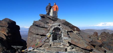
Perched precariously on Mulhacen summit point!
There is a well signposted track going up left of the forestry station. Head straight uphill through the forest on a marked and good track. This zig-zags uphill. When you leave the top end of the forest the path nearly meets a forest break (with a signpost beyond signalling the way to the Poqueira Hut) before zig zagging back right and upwards to reach the old road. Follow this.
2hrs after starting you will arrive at the Mirador de Trevelez (a nice place for a breakfast stop will be found 30m to the right by some rocks overlooking the town of Trevelez). Continuing on the old road for 400m, a faint track leaves the road heading rightwards. This is the main south ridge access track. Follow to the south summit and hence to the main summit of Mulhacen (2.5 to 3hrs from Mirador de Trevelez).
Mulhacen descent
From the summit drop 50m south to a point where 2 adjacent cairns mark the start of the west flank path. Follow the track west. This steepens until the full extent of the west flank is seen below. Great views to the Caldera and Veleta areas. This is an unrelenting descent of 500m in a series of steep zig-zags. But it is quick! You should be down at the old road in 40 minutes.
Turn left (south) on the old road which passes over the "Paso de los Franceses" and eventually nears the Alto de Chorillo and the ascent route. Some 400m before the Alto de Chorrillo bear right down over pathless terrain to meet the road that goes from the Poqueira hut to the Alto de Chorrillo. Then, at the first left hand bend in the track take the traverse path south. Follow this along the mountainside. It passes through a forested area before arriving at the forest break above the Hoya del Portillo.
Follow the firebreak down. It is a bit rough, but no rougher than the Mulhacen slopes tackled previously. After 10 minutes you will see a small cairn on the left (looking down) that signifies a small path that enters the forest. Take this path. It is very faint in places but if you generally head a a descending traverse you are bound to reach the forest road or visitor car parks at the Hoya del Portillo.
And that's it! A 24km walk up and down Mulhacen without ever having crossed the same tracks twice. It will take you between 7 and 9 hours with nearly 1200m of ascent. The Map and Google Earth Tour below will show you the route to be taken. There are links to altitude profiles and more mapping data.