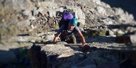
The Espolón de la Caldera is in fact the NW ridge of the Puntal de la Caldera, found just to the west of Mulhacén's, Collado de Ciervo, in Spain's Sierra Nevada mountains. It gives a rough and sometimes loose scramble with many possibilities for making the ascent easier or tougher to suit. At it's easiest it's a Grade 2 scramble, and I guess about VD (4/4+) if the steps and pinnacles are taken direct. Difficult and dangerous to descend or escape due to the loose nature of many areas.
There are no internet reports nor photos of foreigners ever having done this before, maybe it was a first British ascent?
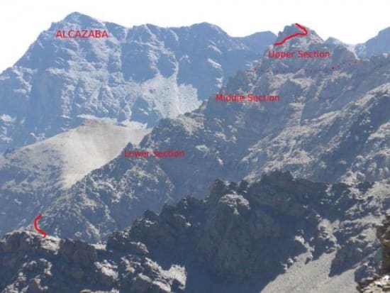
The Espolón de la Caldera as seen from the west (Col de Lobo)
Approaches
-
From the Refugio Poqueira - up the Rio Mulhacén to the Collado de Ciervo. Down towards the peak of Juego de Bolos, west on a good path under the north face to the start of the route (3hrs)
-
From the upper ski lifts at the Sierra Nevada ski station - Along the old road via the Collado de Carihuela, Paso de las Guias, Paso de los Machos. After passing through the cutting of the Raspones ridge look for a cairn on the left. Go up to the col, cross over the main ridge and follow the steep path down to Lagunas Larga and Galbata. The ridge start is 10 minutes from Laguna Larga (2hrs)
-
From Posiciones de Veleta enter the Coral via the Veredon Superior path. Drop down the valley and then take the steep zig zag loose path to the Col near Veta Grande. Follow the path down into the next valley and traverse the flanks to the Lagunas aforementioned (3hrs)
We took the 3rd and in my opinion best option. A grand traverse of the northern flanks in quiet and spectacular surroundings. We set up a bivouac at Laguna Galbata, a delightful place to camp!
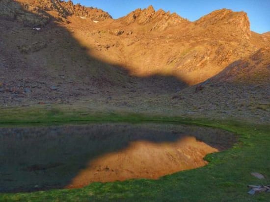
Sunrise over Laguna Galbata
The Climb
We set off at first light to avoid the fierce July heat. It's only 10 minutes to the start where the path cuts across the base of the ridge. It's easy "hands in pocket" going for the first 15 minutes up gently sloping slabs.
Then the first pinnacles are met. Quite solid rock around here, so don't be too tempted to take easier (and looser!) routes off to the left, take the rock buttresses head on for the most enjoyment.
A level section follows and gives time for a short rest, with superb views back down to the Lagunas and across to Cerro de los Machos. Above things look tougher though.
The middle section of the climb is quite clearly on poorer rock. Yellow, broken rock abounds here. Test each hold carefully, especially if taken direct. Escape lies to the left but will put you on some exposed and loose terrain.
Above the middle section at a short col and "escape" can be made to the right along a faint goat track to reach the west ridge coming from Loma Pelada (marked with a dotted line on the photo) but this would detract from the quality of the finishing line leading to the summit.
The upper section is on much better rock so be bold and enjoy the airy and spectacular surroundings. As you top out onto the summit ridge the southern side of the Sierra Nevada comes into view with the Laguna de la Caldera far below you.
Descents
-
Down the east ridge to Collado del Ciervo. Short easy scrambling sections (30 mins)
-
Direct down steep scree to the Refugio de la Caldera (30 mins)
-
West along the ridge to Loma Pelada. Some rough scrambling sections (1hr 15 mins)
The Espolón is well worth a look if you like your mountains rough, spectacular and quiet. We met nobody else between Posiciones de Veleta and Refugio de la Caldera

Steep slabby section

The loose centre section of the ridge
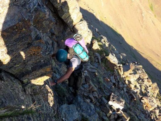
On the initial section

Looking across the NW face
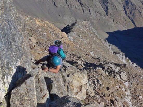
On the upper pinnacles

Looking down the ridge from half height

Topping out very close to the summit

Heading down the east ridge to Col de Ciervo. Laguna de la Mosca below
